CJohnStanchina
Active Member
- First Name
- CJohn
- Joined
- Mar 2, 2020
- Threads
- 2
- Messages
- 43
- Reaction score
- 51
- Location
- Maple Grove, MN
- Vehicle(s)
- 2019 Ford Ranger Lariat 4x4 SuperCab
- Thread starter
- #1
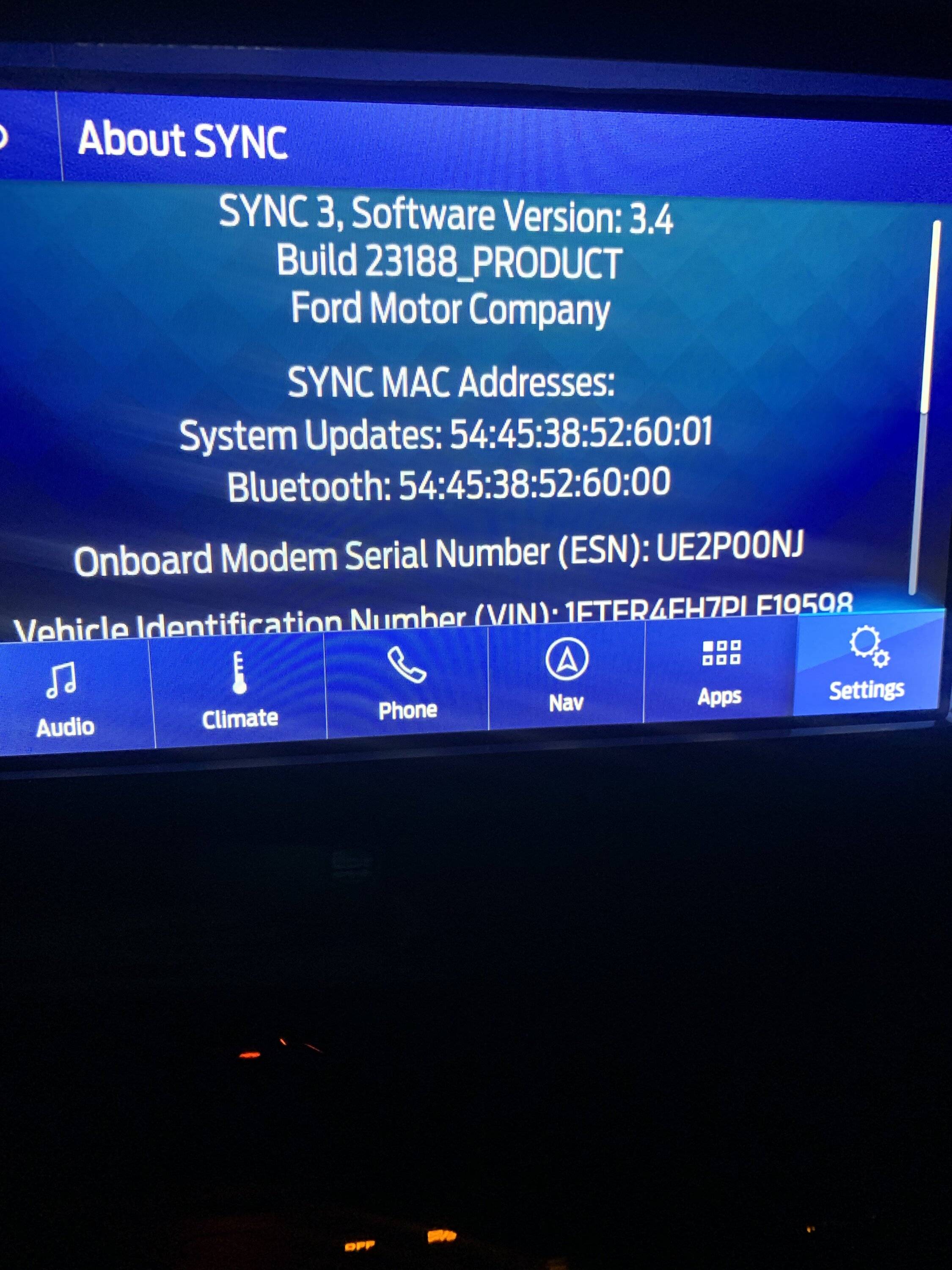
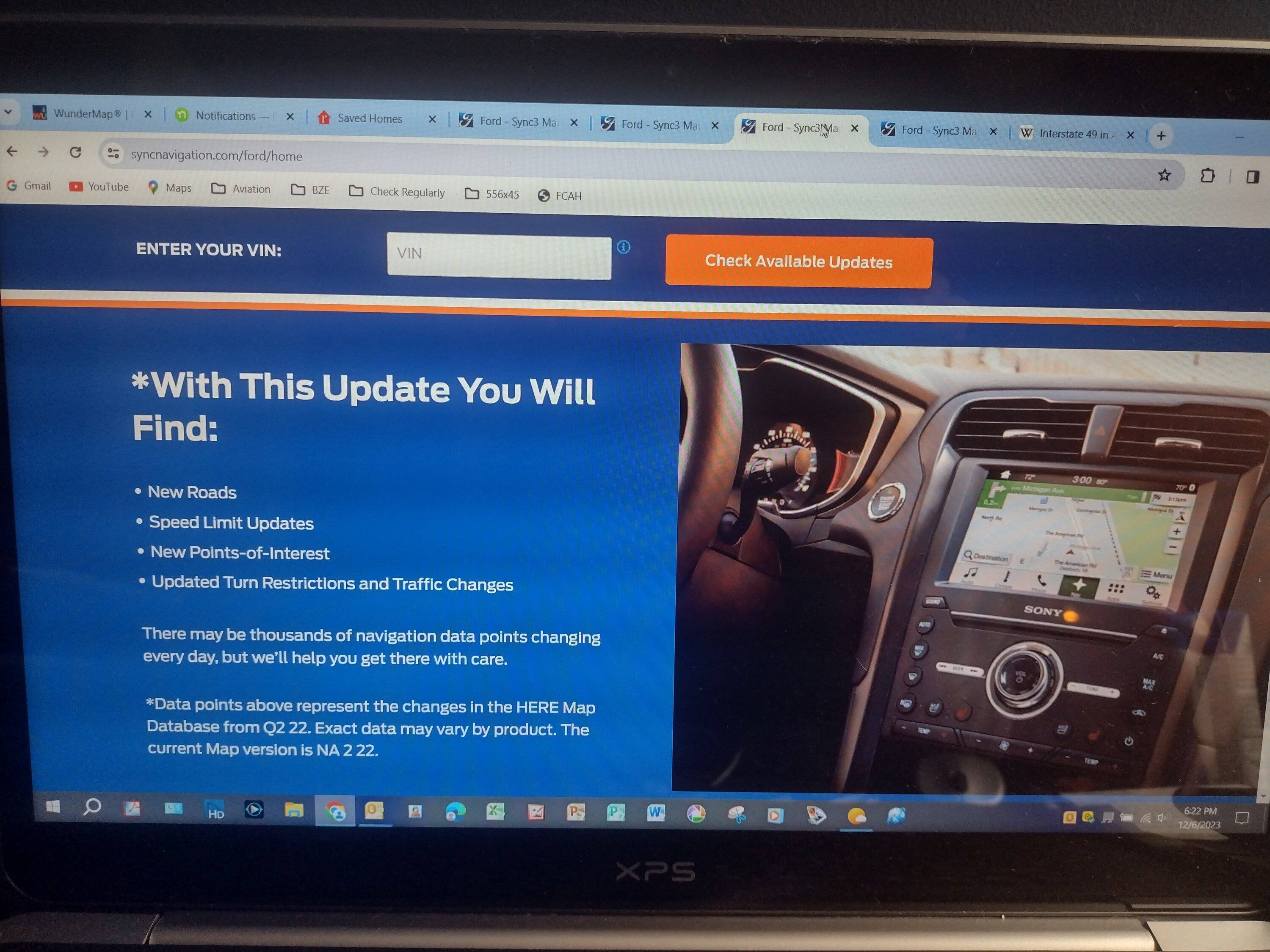
I recently tried to update my maps to NA 2 22 and got the dreaded MEM_ERR01 error message just moments after plugging in my USB drive. However, my About SYNC screen shows my current Navigation Maps Version as NA 2 22. During my attempted update, no screens changed, no restarts occurred, and the USB wasn't plugged in for anywhere close to the 60 minutes Ford claims the update will take.
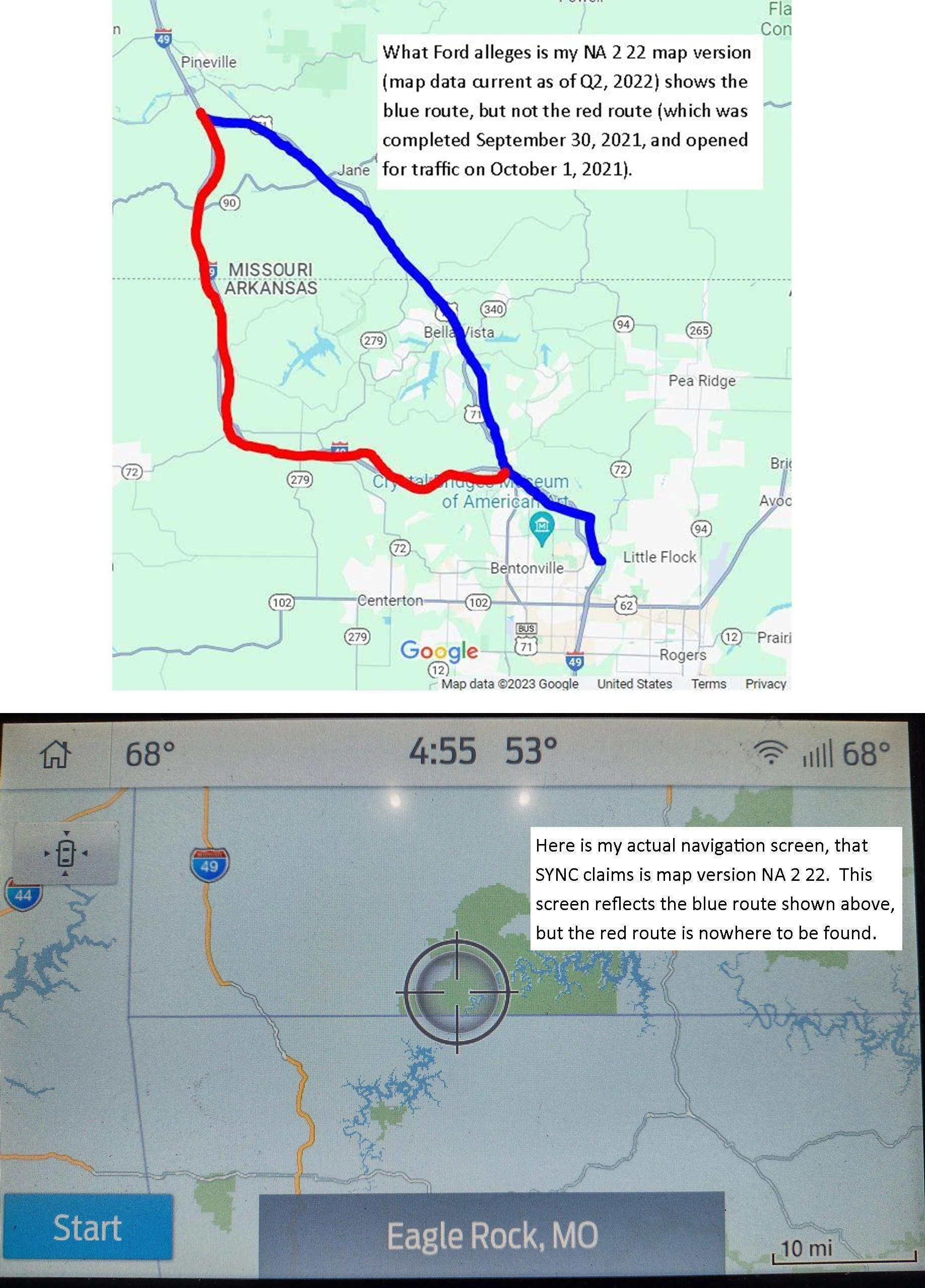
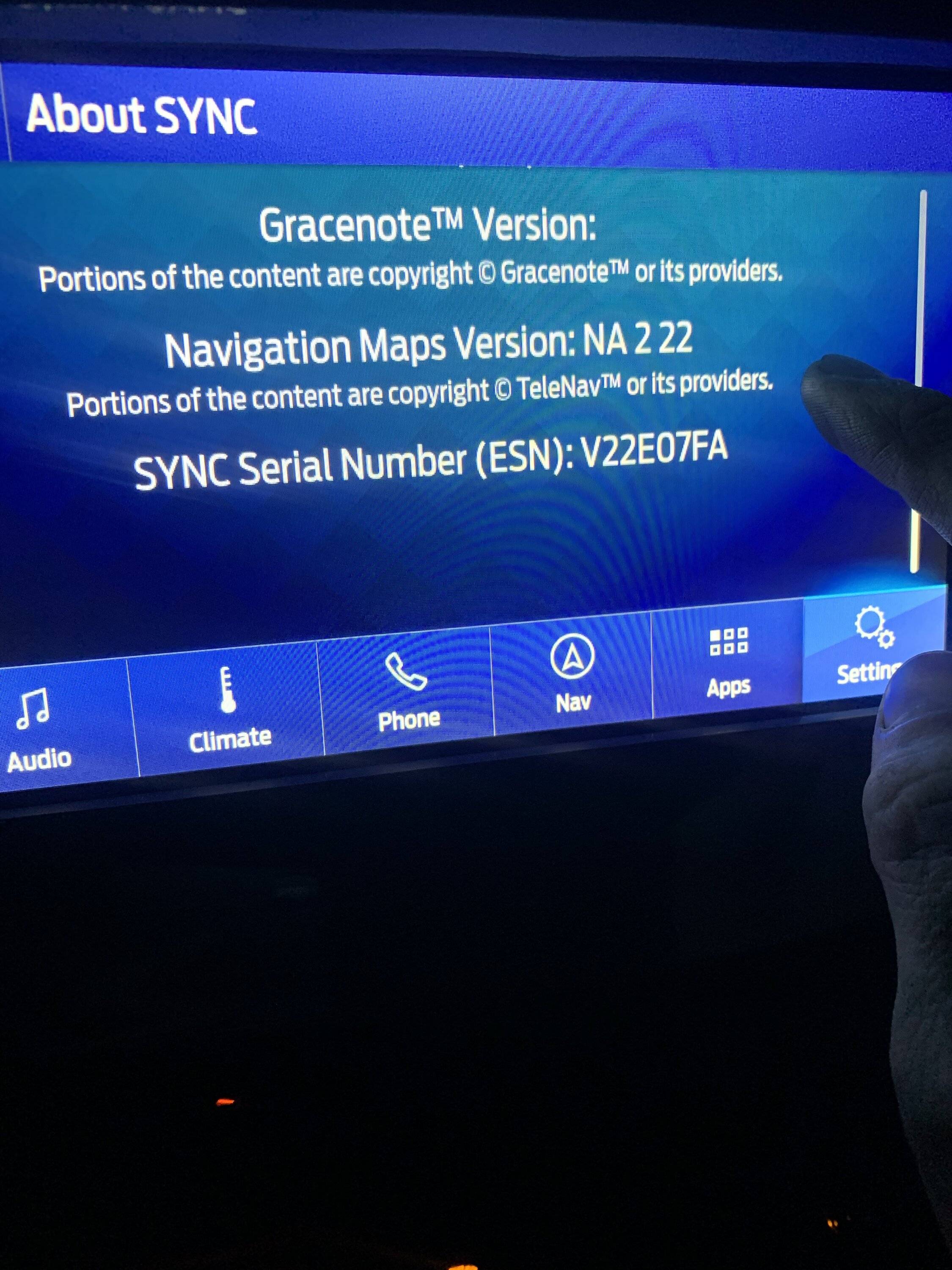
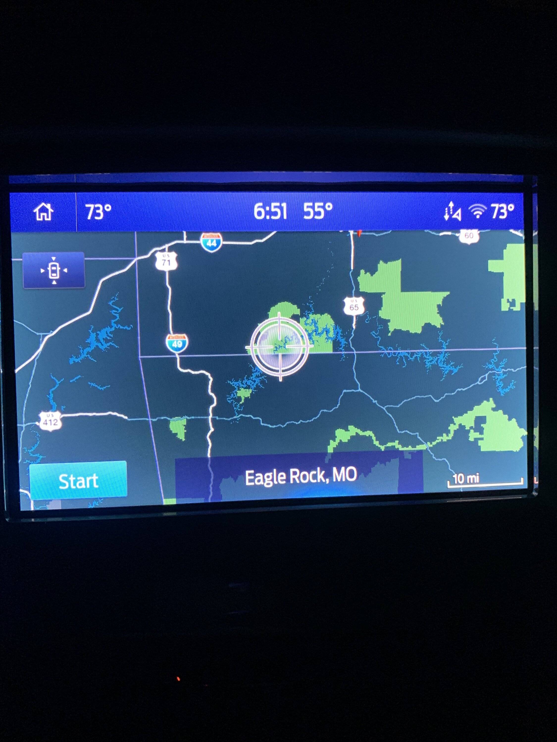
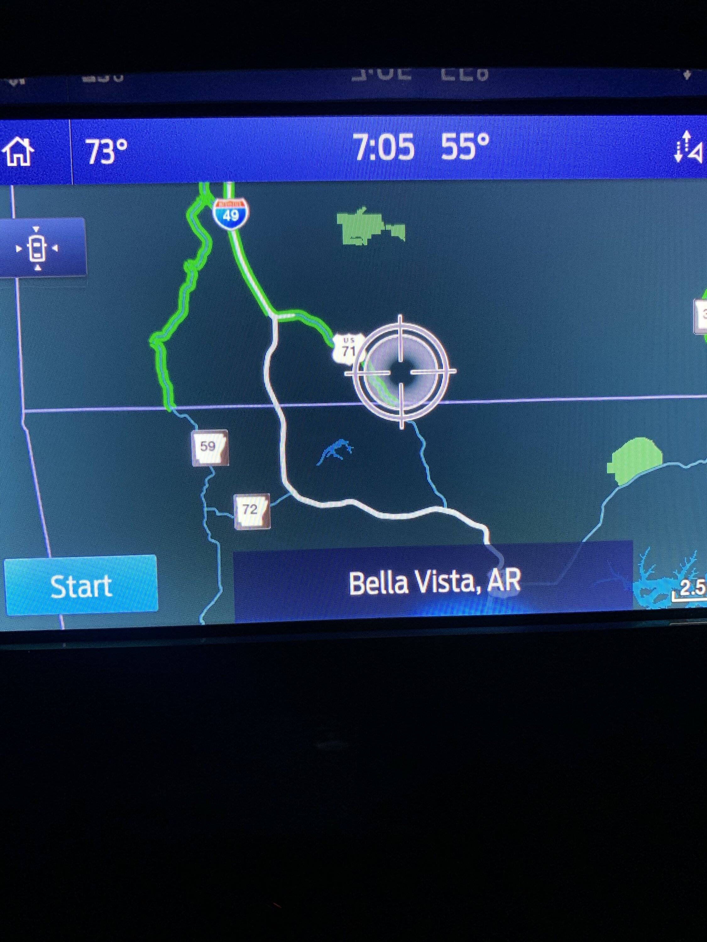
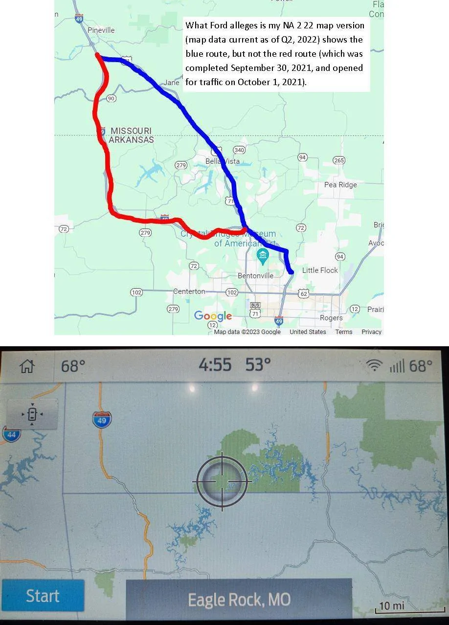
Ford's CRC claims that the update must have completed on its own. Here's the problem with that: ALOM (the company that provides the map updates) claims that NA 2 22 reflects map data that are current as of Quarter 2, 2022 (see attached screen photo). Yet when I drag my navigation screen to NW AR, it doesn't show the I-49 Bella Vista Bypass which was completed on September 30, 2021, and opened to traffic the very next day (also see attached screen photos of my Navigation screen compared with an annotated Google Maps screen photo).
So what I'm asking is this: If you're running SYNC 3.4, Build 23188 with Navigation Maps Version NA 2 22, could you please drag your Navigation screen to show NW AR and take a picture of it for me? If your screen shows the I-49 Bella Vista Bypass, then I will have confirmation that Ford CRC's assertion that my update completed successfully is WRONG, and that they need to do something about it.
Thanks in advance for your help!
Sponsored